African cities, particularly in Kenya, are growing at an unprecedented rate, bringing challenges like traffic congestion, safety risks, and inefficient resource allocation. ONFIX by Boldstreet Partners approaches these urban complexities as interconnected systems, ingesting diverse data streams from cameras, vehicle telemetry, and air quality sensors to generate short-term forecasts and actionable insights. For developments in Nairobi or emerging smart cities like Konza Technopolis, ONFIX delivers tangible benefits: reduced congestion on key corridors, faster emergency responses, and data-driven infrastructure decisions that optimize public spending. This article breaks down the problems ONFIX addresses, its operational mechanics, key use cases with proven outcomes, policy planning tools, and a practical guide to implementation, empowering city managers and planners to build safer, more efficient urban environments.
Problems ONFIX solves
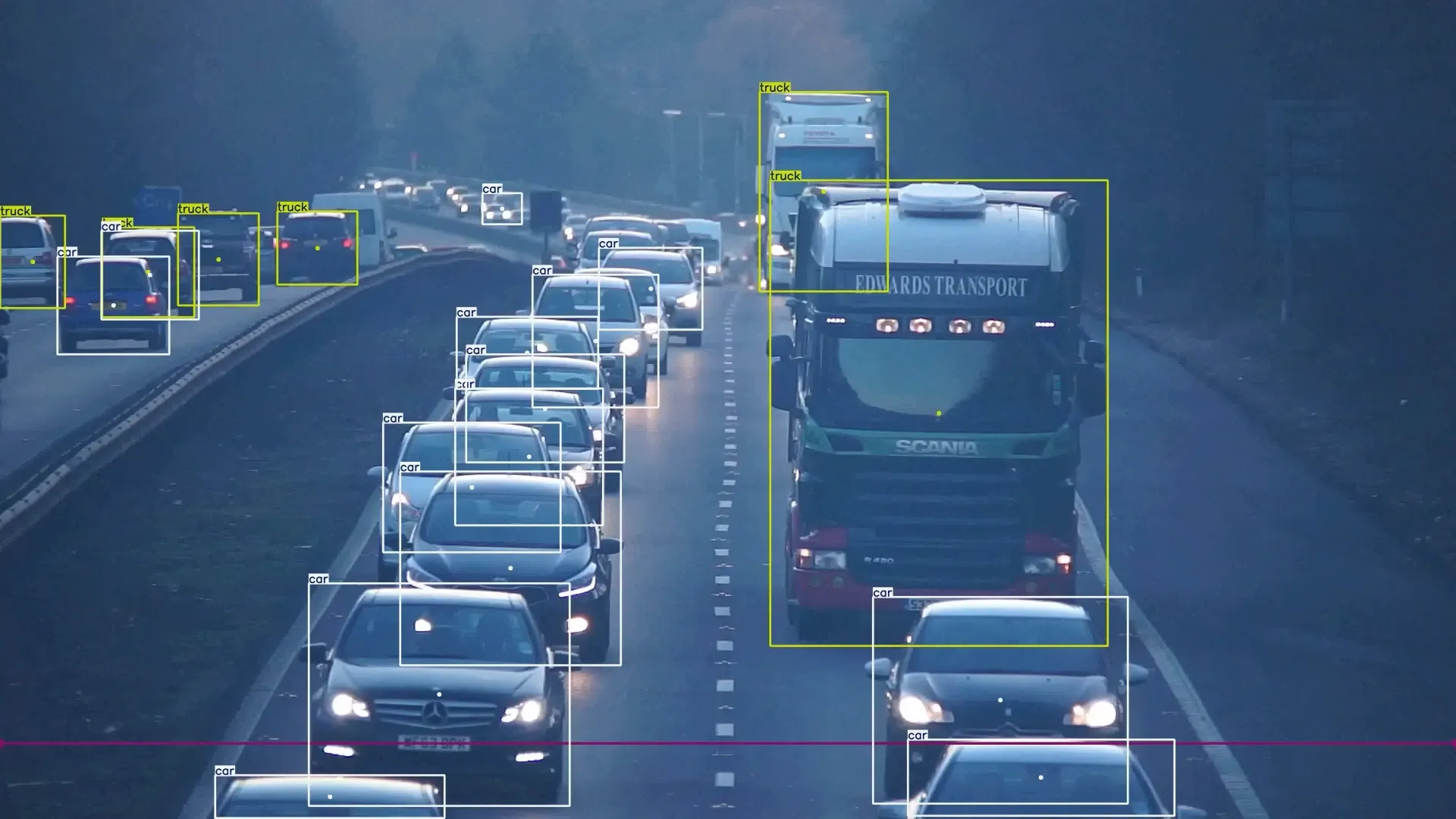
Chronic congestion plagues mixed-transport corridors in Kenyan cities, where matatus, boda-bodas, cars, and pedestrians compete for space, leading to hours of lost productivity daily and increased accident risks.
Emergency responses are often reactive, relying on citizen reports rather than predictive signals, which delays interventions in critical situations like accidents or medical emergencies on busy roads.
Without reliable data, infrastructure prioritization becomes guesswork, resulting in misallocated budgets on projects that fail to address root causes, such as underutilized roads or overlooked pedestrian hotspots.
How ONFIX works (brief)
Edge nodes play a pivotal role by normalizing disparate data from cameras and sensors into unified event streams, enabling real-time processing without overwhelming central servers.
Predictive models use machine learning to forecast congestion patterns 0–60 minutes ahead, factoring in variables like time of day, weather, and historical trends specific to Nairobi's traffic dynamics.
Control-room dashboards and public APIs provide intuitive interfaces for operators to access optimized routes, estimated times of arrival (ETAs), and automated alerts, while public APIs allow integration with apps for citizen-facing services like real-time transit updates.
Use cases with outcomes
Corridor management: By providing short-horizon forecasts, ONFIX enables dynamic traffic signal timing adjustments, which have shown to reduce peak-hour congestion by 15-25% in pilot zones, easing flow on routes like Thika Road.
Event management: During large gatherings such as concerts or protests, pre-emptive crowd routing algorithms prevent dangerous density, enhancing safety and minimizing disruptions in public spaces.
Pollution control: ONFIX correlates traffic data with PM2.5 air quality spikes, recommending temporary restrictions like vehicle bans in high-pollution zones, leading to measurable improvements in urban air quality and public health.
Policy & planning
ONFIX's 'what-if' simulation tools empower planners to model the impacts of proposed changes, such as adding bus lanes, closing roads for maintenance, or introducing bike paths. Using historical data and AI-driven projections, these simulations provide evidence-based insights to justify investments, ensuring Kenyan cities evolve sustainably and equitably.
Operationalizing ONFIX
Kick off with a 3–6 zone pilot in high-impact areas like Nairobi's CBD to test data integration and forecast accuracy in real conditions.
Seamlessly integrate ONfix with existing traffic operations centers and emergency services for unified alerting and response coordination.
Leverage the generated evidence—such as congestion reduction metrics—to secure funding and approvals for targeted capital investments in infrastructure upgrades.